Hazardous winter conditions are expected this week
Environment Canada has issued a winter storm warning in effect for Tuesday and Wednesday. Heavy snow and blowing snow on tap beginning tomorrow.
A low pressure system forming over the Central United States will intensify into a winter storm towards New England. Snow and blowing snow associated with this system will begin to affect Southern Quebec by Tuesday morning and the Quebec City area my mid to late afternoon, and Eastern Quebec by Tuesday evening.
Generaly, between 15 to 30 centimeters of snow can be expected. Up to 45 centimeters of snow could fall over the Eastern Townships, Beauce, Charlevoix and parts of the Gaspe Peninsula.
Blowing snow
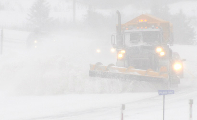
Winds gusting from 70 to 100 kilometers per hour will greatly reduce visibilities in blowing snow, especially in the Saint-Lawrence Valley. This storm will continue to track over the Lower North Shore Tuesday night and Wednesday.
"Consider postponing non-essential travel until conditions improve. Visibility may be suddenly reduced to near zero at times in heavy snow and blowing snow. Road closures are possible", says Environment Canada.
Brome-Missisquoi, Châteauguay – La Prairie, Coaticook, Granby – Waterloo, Hemmingford, Huntingdon, Lacolle, Longueuil – Varennes, Mont-Orford – lac Memphrémagog, Saint-Jean – Marieville, Saint-Rémi, Sorel – Yamaska, Soulanges, Valleyfield – Beauharnois, Vaudreuil et Verchères – Beloeil are the areas affect by the winter storm warning.
TC Media